
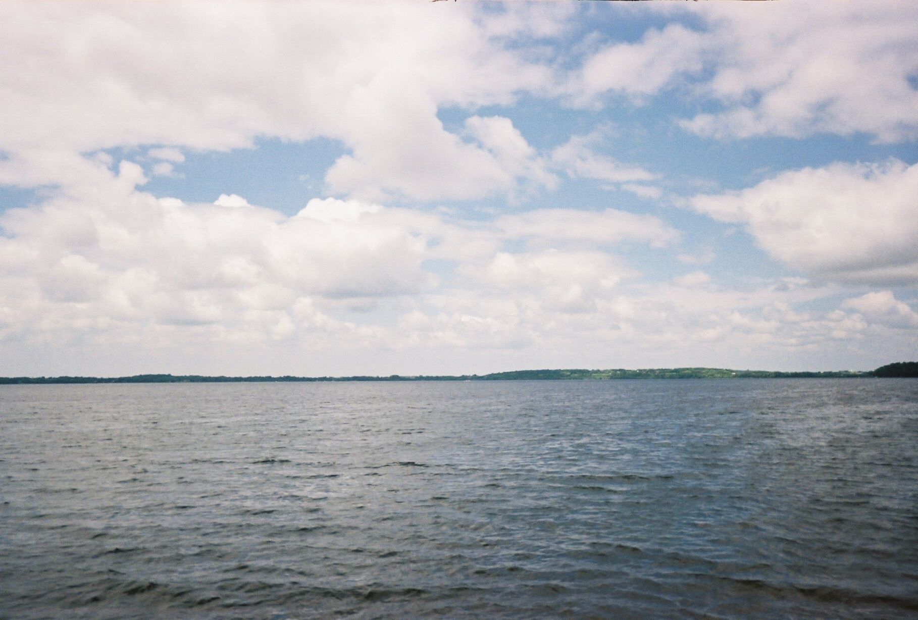
Lake Waconia is a 3,080-acre lake in Carver County, 37 feet at its deepest, with 10.9 miles of shoreline. The City of Waconia sits on the southern shore. The city calls it the second-largest lake in the seven-county metropolitan area. A 34-acre historic island, Coney Island of the West, sits in the lake and is open as a county park. Tim Ornell represents shoreline homes on and around the lake.
Lake Waconia | Minnesota
At aglance
| Size | 3,080 acres, 10.9 miles of shoreline (Minnesota DNR LakeFinder, DOW 10005900, 3,080.35 acres and 10.88 miles, retrieved November 21, 2026) |
| Depth | 37 feet maximum. About 1,784 acres, or 58% of the lake, is littoral, 15 feet deep or less, where plants can grow (DNR LakeFinder, 1,783.65 littoral acres). The LakeFinder record does not publish a mean depth. |
| Water clarity | Survey average Secchi depth 5.9 feet. 7.0 feet on August 4, 2025, described as clear, with moderately good clarity (DNR LakeFinder; DNR standard survey, August 4, 2025) |
| Water quality | The Minnesota Pollution Control Agency lists the lake as impaired for mercury in fish tissue and for fish bioassessments, in the Lower Minnesota River watershed. The City of Waconia notes that water quality has improved since monitoring began in 1973 (MPCA surface-water dashboard for 10-0059-00; City of Waconia) |
| Island | Coney Island of the West, 34 acres, listed on the National Register of Historic Places. Owned and managed by Carver County Parks. Reached by personal boat, with docks on the west and east sides (Carver County Parks; City of Waconia) |
| Communities | City of Waconia, on the southern shore, in Carver County. Shoreline parcels may also lie in adjoining townships, including Laketown Township on the east. Confirm the city or township for each parcel. |
| Park | Lake Waconia Regional Park, 164 acres on the southern shore at 8170 Paradise Lane, east of downtown along Highway 5. Swimming beach, picnic areas, trails, boat access, and Paradise Commons, opened in 2024. Open 6 a.m. to 10 p.m. (Carver County Parks) |
| Public access | Three public accesses: a DNR launch on the east side near County Road 30 and 155 (parking for up to 40 vehicle-trailer units); two concrete ramps at the regional park on the southeast shore (parking for up to 34); and a city launch on the southwest side off Lakeview Terrace Boulevard, used mainly in winter (parking for up to 8) (DNR standard survey, August 4, 2025; DNR LakeFinder) |
| Fishing | Managed mainly for walleye and muskellunge. Walleye special regulation: 16-inch minimum length. Walleye fingerlings stocked at 1,660 pounds biennially; muskellunge fingerlings (830 fish) stocked annually in the fall (DNR LakeFinder; DNR standard survey, August 4, 2025) |
| Invasive species | Eurasian watermilfoil and zebra mussels (DNR LakeFinder). Zebra mussels were discovered in 2014 (DNR survey narrative, 2016) |
| Schools | Homes around the lake are generally served by Waconia Public Schools (ISD 110); confirm school assignment by address with the district. |
| Market | Sale prices and days on market are not listed on this page. They will be added only from a dated MLS source. |
Lake Waconia | Minnesota
Buying on Waconiawhat Tim watches
- Know which city or township you are in. The City of Waconia sits on the southern shore. Parcels on other sides of the lake may be in an adjoining township, including Laketown Township on the east. Taxes, zoning, setbacks, and sewer or septic rules follow that jurisdiction. Confirm the parcel before you write an offer.
- It is a large, relatively shallow lake. Lake Waconia covers 3,080 acres and is 37 feet at its deepest, but about 58% of the surface is 15 feet deep or less. In the August 4, 2025, survey, dissolved oxygen fell to zero at 28 feet, and the DNR noted that fish would be unable to use water deeper than 18 feet in mid-summer. A dock and a weed plan matter here.
- Coney Island is a public park, not a private island. The 34-acre island is a Carver County park on the National Register of Historic Places. It is reached by boat, with public docks and a sandy landing. Camping is not allowed. The view of the island is part of the lake, and so is public use of it.
- The south and east shores see public use. A regional park, a swimming beach, and two of the three public launches sit on the south and southeast side, with a DNR launch on the east. The city launch on the southwest side is used mainly in winter. Ask what that means for the specific shore you are considering.
- Read the water with current numbers. Average survey clarity is 5.9 feet. It measured 7.0 feet on August 4, 2025, and 3 feet on August 5, 2019. Spring readings can be much higher. The MPCA lists impairments for mercury in fish tissue and for fish bioassessments. Ask for the latest official reading, not a neighbor's memory of a clear May day.
- Invasive species are present. The DNR lists Eurasian watermilfoil and zebra mussels. Zebra mussels were discovered in 2014. Minnesota's clean, drain, dispose rules apply to every launch and every private ramp.
- School assignment depends on the address. Homes around the lake are generally served by Waconia Public Schools (ISD 110); confirm school assignment by address with the district.
- If nothing is listed, ask. Owners who want a quiet sale can use Private Shoreline. Tim can ask. There is no promise a buyer or a seller is waiting.
Lake Waconia | Minnesota
Selling onWaconia
- Name the city or township. Taxes, zoning, setbacks, and utilities change with the jurisdiction. State it clearly in the listing remarks.
- Show the water as it is. Share the latest DNR or MPCA clarity figures, the invasive species on the official list, and current beach or launch conditions if they affect a showing. Official numbers travel better than a story about a clear weekend.
- Be ready on the dock and the shoreline. Dock and shoreline work is subject to Minnesota DNR public-waters rules, and grading or stormwater work may need a permit from the Carver County Water Management Organization. Confirm current local rules before you promise a buyer a change.
- A quiet sale is an option. Owners who want to sell off the open market can use Private Shoreline. Write to [email protected] or call 651.263.9480.
Lake Waconia | Minnesota
Livingthere
The park
Lake Waconia Regional Park covers 164 acres along the southern shore, at 8170 Paradise Lane, east of downtown Waconia along Highway 5 (Carver County Parks). The county lists a swimming beach, picnic tables and grills, restrooms, walking trails, boat access, canoe and kayak storage, and reservable event space and picnic shelters. Paradise Commons, a waterfront gathering building with public restrooms, covered seating, and indoor meeting space, opened in 2024. Park hours are 6 a.m. to 10 p.m. An 80-foot sledding hill is typically open from December through March, depending on snow.
Coney Island
Coney Island of the West is a 34-acre historic island in the lake, listed on the National Register of Historic Places and managed by Carver County Parks (Carver County, Coney Island). It is reached by personal boat or watercraft, with docks on the west and east sides and a sandy landing on the east. A half-mile trail crosses the island. Picnic areas are first come, first served. Camping is not allowed, and visitors pack out trash. The city notes that bald eagles, egrets, and blue herons nest on the island.
Downtown
Downtown Waconia sits on the southern shore of the lake, with the regional park a short drive east along Highway 5. The city's official lakes page is the starting point for park and access information (City of Waconia, Lakes). Nearby lakes in the same area, also named by the city, include Reitz Lake, Piersons Lake, Parley Lake, and Hydes Lake.
Schools
Waconia Public Schools (ISD 110) serves Waconia and nearby cities and townships. The district describes itself as about 35 miles west of Minneapolis (Waconia Public Schools). Homes around the lake are generally served by Waconia Public Schools (ISD 110); confirm school assignment by address with the district.
Getting around
The lake and the City of Waconia lie in Carver County, west of the Twin Cities. Highway 5 runs along the south side of the lake, past the regional park and into downtown. Waconia Public Schools describes the district as about 35 miles west of Minneapolis. Drive times to Minneapolis, Saint Paul, and Minneapolis-Saint Paul International Airport depend on the hour and the route; confirm from the specific address.
Winter
DNR ice-out records for Lake Waconia go back to 1940. The most recent recorded ice-out was March 31, 2026 (Minnesota DNR ice-out records). The city access off Lakeview Terrace Boulevard is used mainly in winter, per the 2025 DNR survey. The regional park's sledding hill is typically open from December through March, weather permitting.
Lake Waconia | Minnesota
Before youbuy
Rules by city or township
Confirm every item with the city or township, and with Carver County, before buying or building. Taxes, zoning, setbacks, and whether the parcel is on municipal sewer and water or a well and septic are set locally. Starting points: City of Waconia and Carver County.
Docks and shoreline work
Dock and shoreline work in public waters is regulated by the Minnesota DNR (DNR docks and access in public waters). Many ordinary docks that stay within DNR size and use limits do not need a separate permit, but local rules also apply, and larger platforms or shoreline changes can. Grading, filling, and stormwater work in the watershed may also need a permit from the Carver County Water Management Organization. Confirm current rules before you buy, list, or start work.
Water quality
The lake is a productive west-metro basin. The DNR's 2016 survey described it as eutrophic. Average survey clarity is 5.9 feet. The August 4, 2025, survey measured 7.0 feet. The MPCA lists impairments for mercury in fish tissue and for fish bioassessments (MPCA surface-water dashboard, Waconia 10-0059-00). Follow current fish-consumption guidance. Check beach conditions with Carver County Parks before swimming.
Lake Waconia | Minnesota
History
The City of Waconia says early settlers called the lake Clearwater Lake, and that Coney Island, off the Lakeview Terrace peninsula, became a resort destination for Twin Cities residents in the late 1800s, with more resort buildings and cottages in the early 1900s (City of Waconia, Lakes).
Carver County records that the Zeglin family operated a resort on the island from 1889 through the late 1930s, and that a Waconia wine merchant built seasonal villas around 1911 at the west end, now called Amblard's Point. The east side of the island was used by the University of Minnesota football team for spring training from 1903 to 1905 (Carver County, Coney Island).
The city notes that Lake Minnetonka, closer to the metropolitan area, and destinations in northern Minnesota later drew visitors away, and that cottages and hotels fell into disrepair. Concrete foundations and a fieldstone seawall remain. The island is listed on the National Register of Historic Places. The Metropolitan Council approved the Waconia Regional Park master plan in 2017, per Carver County.
Lake Waconia | Minnesota
Water quality byyear
- 1973The City of Waconia says monitoring of Lake Waconia began, and that water quality has improved since then (City of Waconia, Lakes).
- August 4, 2008DNR survey Secchi depth 4 feet (DNR LakeFinder water-clarity record).
- May 4, 2013DNR survey Secchi depth 13.5 feet, a spring reading, higher than mid-summer figures in the same record (DNR LakeFinder).
- 2014Zebra mussels discovered in Lake Waconia (DNR survey narrative, 2016). June 3 Secchi depth 10 feet; August 4 Secchi depth 4 feet (DNR LakeFinder).
- August 8, 2016DNR survey Secchi depths 4.5 and 6 feet at two sites. The survey described the lake as a productive eutrophic basin and noted a regional-park beach closing in late September 2016 for high E. coli (DNR standard survey, 2016).
- August 5, 2019DNR survey Secchi depth 3 feet, the lowest mid-summer reading in the LakeFinder survey series (DNR LakeFinder).
- August 8, 2022DNR survey Secchi depth 5 feet (DNR LakeFinder).
- August 4, 2025DNR standard survey Secchi depth 7.0 feet. Water described as clear, with moderately good clarity. Walleye gill-net catch 7.1 per net, above the expected rate for similar lakes (DNR standard survey, August 4, 2025). Survey-average clarity on LakeFinder: 5.9 feet.
Lake Waconia | Minnesota
Buying on LakeWaconia
- How big and deep is Lake Waconia?
- Lake Waconia covers 3,080 acres with 10.9 miles of shoreline. It is 37 feet at its deepest, according to the Minnesota DNR LakeFinder (3,080.35 acres and 10.88 miles on the record, retrieved November 21, 2026). About 1,784 acres, or 58% of the lake, is 15 feet deep or less. The DNR record does not publish a mean depth.
- Is Lake Waconia the second-largest lake in the Twin Cities metro?
- The City of Waconia describes Lake Waconia as the second-largest lake in the seven-county metropolitan area. This page uses the Minnesota DNR LakeFinder figure of 3,080 acres. Among lakes the DNR lists in that metro, Lake Minnetonka is larger, at 14,206 acres. The city cites about 3,200 acres; the DNR figure is the one used here.
- What is the water quality on Lake Waconia?
- The DNR LakeFinder lists an average Secchi (water clarity) depth of 5.9 feet from its survey readings. During the August 4, 2025, standard survey, clarity measured 7.0 feet and the water was described as clear, with moderately good clarity. Mid-summer readings in the DNR record have ranged from 3 feet (August 5, 2019) to 7 feet (August 4, 2025). Spring and early-summer readings can be higher; a May 4, 2013, reading was 13.5 feet. The Minnesota Pollution Control Agency lists the lake as impaired for mercury in fish tissue and for fish bioassessments, and places it in the Lower Minnesota River watershed. The City of Waconia notes that water quality has improved since monitoring began in 1973. Follow current fish-consumption guidance from the Minnesota Department of Health and the DNR.
- Can you swim in Lake Waconia?
- Yes. Carver County operates a swimming beach at Lake Waconia Regional Park, a 164-acre park on the southern shore at 8170 Paradise Lane, east of downtown Waconia along Highway 5. Park hours are 6 a.m. to 10 p.m. Clarity and bacteria conditions change through the season, and the beach has been closed at times in past years when tests required it, including a closing noted in the DNR's 2016 survey narrative for high E. coli. Check current beach conditions with Carver County Parks before you go.
- What fish are in Lake Waconia?
- The DNR primarily manages Lake Waconia for walleye and muskellunge. Walleye have a special regulation: a 16-inch minimum length. The DNR stocks walleye fingerlings at 1,660 pounds biennially and muskellunge fingerlings (830 fish) annually in the fall. The lake also holds largemouth bass, northern pike, bluegill, pumpkinseed, and black crappie. The LakeFinder species list also includes yellow perch, hybrid sunfish, green sunfish, yellow bullhead, black bullhead, brown bullhead, freshwater drum, common carp, and bigmouth buffalo. In the August 4, 2025, standard survey, walleye gill-net catch was 7.1 per net, above the expected rate for similar lakes, with an average length of 18.1 inches and a largest fish of 26.6 inches.
- Is there public access to Lake Waconia?
- Yes. The DNR's August 4, 2025, survey lists three public water accesses. A DNR access on the east side, near the intersection of County Road 30 and 155 (Laketown Parkway), has a concrete ramp and parking for up to 40 vehicle-trailer units. A second access at Lake Waconia Regional Park, on the southeast shore, has two concrete ramps and parking for up to 34 vehicle-trailer units; Carver County notes two boarding docks there. A third access, maintained by the City of Waconia on the southwest side off Lakeview Terrace Boulevard, has a concrete ramp and parking for up to 8 vehicle-trailer units and is used mainly in winter. The city also notes a private marina in town.
- What is Coney Island on Lake Waconia?
- Coney Island of the West is a 34-acre island in Lake Waconia, listed on the National Register of Historic Places and owned and managed by Carver County Parks. It is reached by personal boat or watercraft, with docks on the west and east sides and a sandy landing on the east side. Amenities include picnic tables, grills, a seasonal restroom, a half-mile trail, and open green space. Camping is not allowed. The west side, Amblard's Point, has picnic grounds and historic ruins from the resort era. The island was a Twin Cities resort destination in the late 1800s and early 1900s.
- Which city and school district is a Lake Waconia home in?
- The City of Waconia sits on the southern shore, in Carver County. Shoreline parcels may also lie in adjoining townships, including Laketown Township on the east side of the lake. Taxes, zoning, setbacks, and sewer or septic rules follow the city or township, so confirm the parcel before you write an offer. Waconia Public Schools (Independent School District 110) serves the area. Homes around the lake are generally served by Waconia Public Schools (ISD 110); confirm school assignment by address with the district.
- Are there invasive species in Lake Waconia?
- Yes. The DNR LakeFinder lists Eurasian watermilfoil and zebra mussels. The DNR's 2016 survey narrative states that zebra mussels were discovered in 2014, and the 2025 survey notes that both species remain present. Minnesota's clean, drain, dispose law applies: clean plants and invasive species from boats, trailers, and equipment; drain water and remove drain plugs for transport; and dispose of unwanted bait in the trash.
- What is the history of Lake Waconia and Coney Island?
- The City of Waconia says early settlers called the lake Clearwater Lake, and that Coney Island, off the Lakeview Terrace peninsula, was once a major attraction, becoming a resort destination for Twin Cities residents in the late 1800s. Carver County records that the Zeglin family operated a resort on the island from 1889 through the late 1930s, that a Waconia wine merchant built seasonal villas around 1911 at what is now called Amblard's Point, and that the University of Minnesota football team used the east side for spring training from 1903 to 1905. The city notes that the island later lost visitors to Lake Minnetonka and to destinations farther north, and that cottages and hotels fell into disrepair. The island is listed on the National Register of Historic Places and is now a Carver County park.
Lake Waconia | Minnesota
Selling on LakeWaconia
- I own on Lake Waconia. What should I have ready before I list?
- Have the official lake facts at hand: size and depth from the DNR, the latest clarity reading, the invasive species on the DNR list, and which city or township the parcel is in. Buyers will also ask about the dock, shoreline work, and whether the lot is on municipal sewer and water or a well and septic. Share current DNR and county information rather than a memory of a clear June day. This page does not publish sale prices or days on market, because no dated MLS figures were compiled for it.
- Which city's rules apply to a Lake Waconia property?
- The City of Waconia sits on the southern shore. Other shoreline parcels may be in an adjoining township, including Laketown Township on the east. Taxes, zoning, setbacks, and utilities follow that jurisdiction. Dock and shoreline work is also subject to Minnesota DNR public-waters rules, and grading or stormwater work may need a permit from the Carver County Water Management Organization. Confirm current rules with the city or township, the county, and the DNR before you list or start work.
- Can I sell a Lake Waconia home off the open market?
- Yes. Owners who want a quiet sale can use Private Shoreline. Tim can ask whether a buyer is already looking. There is no promise a buyer is waiting. Write to [email protected] or call 651.263.9480.
- Does Tim Ornell work with homes on Lake Waconia?
- Yes. Tim Ornell, a Realtor with Real Broker's Luxury Division, represents shoreline homes on and around Lake Waconia, and on Twin Cities lakes at all price points. If you own on Lake Waconia and are thinking about selling, or want to buy here, call 651.263.9480 or write to [email protected].
Lake Waconia | Minnesota
Sources
Lake facts, depth, littoral area, shoreline, species list, invasive species, special walleye regulation, and access records: Minnesota DNR LakeFinder for Waconia (DOW 10005900), LakeFinder lake page and the LakeFinder Search by ID API, retrieved November 21, 2026 (3,080.35 acres, 10.88 miles of shoreline, 37 feet maximum depth, 1,783.65 littoral acres, average survey Secchi depth 5.9 feet). The LakeFinder record does not publish a mean depth (the morphology field is blank / zero). Fishing management, stocking, the three public accesses, 2025 water clarity, dissolved oxygen, and catch summaries: Minnesota DNR standard survey narrative for Lake Waconia, August 4, 2025, retrieved from the DNR lake-survey service on November 21, 2026. The 2025 narrative states 3,080 acres and 1,660 littoral acres, and uses 1,660 pounds as the biennial walleye fingerling stocking rate (1 pound per littoral acre). This page uses the LakeFinder littoral figure of 1,784 acres for the basin, and the survey's 1,660-pound figure for stocking. Zebra mussels discovered in 2014, and the 2016 eutrophic description and beach closing: DNR standard survey narrative, August 8, 2016. Ice-out: Minnesota DNR ice-out records for Waconia, 10005900, most recent recorded ice-out March 31, 2026. Docks: Minnesota DNR, Docks and access in public waters.
Water quality and watershed: Minnesota Pollution Control Agency surface-water dashboard for Waconia, 10-0059-00, retrieved November 21, 2026 (impairments for mercury in fish tissue and fish bioassessments; Lower Minnesota River major watershed; MPCA surface area 3,066.46 acres and maximum depth 37 feet). This page uses the DNR LakeFinder acreage for size. Watershed permits: Carver County Water Management Organization, permits.
Park, beach, and island: Carver County, Lake Waconia Regional Park and Carver County, Coney Island, retrieved November 21, 2026. City facts, historic name, resort-era summary, and the second-largest-lake statement: City of Waconia, Lakes, retrieved November 21, 2026. The city cites about 3,200 acres; this page uses the DNR figure of 3,080 acres. Schools: Waconia Public Schools, Why Waconia and ISD 110 district boundary map, retrieved November 21, 2026. Metropolitan Council approval of the Waconia Regional Park master plan in 2017 is cited from the Carver County Coney Island page. Information deemed reliable but not guaranteed.

Tim Ornell | Real Broker Luxury Division
A note
from Tim
Waconia is the big west metro lake I point people toward when they want open water, a walkable town on the south shore, and a historic island in the middle of the lake. If you are looking for a place on this shore, or you are thinking about selling, I would like to help.
Best, Tim
Tim Ornell, Luxury Realtor
651.263.9480
[email protected]
timornell.com
Real Broker, LLC